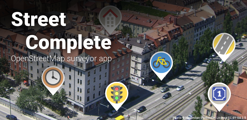
I love this App! I startest using it arounf a year ago and am already rank 2526 globally :) It's so nice to have a reason to take a walk while doing sonething useful.
Free and Open Source Software
If it's free and open source and it's also software, it can be discussed here. Subcommunity of Technology.
This community's icon was made by Aaron Schneider, under the CC-BY-NC-SA 4.0 license.
this looks like wonderful program to use, my only worry is that how well openstreetmap is safeguarded against any corporation wanting to buy it out? This kind of community effort could easily make it vastly superior to anything corporations even could create so obviously they will try to acquire it at some point. Is it safe from that?
But provided that it is safe, this is really nice. I like going to new places but not having any real reason for it makes it feel a bit trivial. With this there is real tangible benefit for doing it.
Love StreetComplete! my current rank is 143, need to remember to use it more when i got out. I can also recommend Forest for even more motivation to walk around🌲
I love counting steps
I also recommend SC Expanded and Extended if you have experience with StreetComplete. It adds direct editing functionality and more quests.
My car died and I'm not currently employed due to disability so I've got nothing better to do than to walk around. I combine Street Complete with Randonautica to find new places to go. I'm running out of places with quests near where I live (Dayton, Ohio), it is causing me to exercise more. https://i.imgur.com/w3F0wtw.png
Have a look at your area on www.openstreetmap.org and see if anything is missing. You can add it to the map, and before too long, StreetComplete will have quests based on the new data.
My area had roads but very few buildings, so now I get quests for the buildings I've added based on data that I couldn't see on the aerial map 🙂
I have an OSM account and even resolved a note or two. I've cleared every SC quest within a mile+ from my apartment and for the most part things look accurate. There are a couple fixes that need done but I also have severe ADHD. I absolutely WILL mess things up in OSM. That's why Street Complete is perfect for me, it removes all possibility of me making catastrophic changes erroneously.
For example, a library near me was torn down and a new one was built across the street from where it was. The old ones location is the new ones parking lot and the new one is where a business used to be. The road and sidewalks around them were also redone in a slightly different layout. I looked into correcting this and quickly learned I'm not capable of fixing it in OSM. I could try. However if it can't be done in about 45 seconds, I wont finish what I start. I left a note instead, so hopefully someone with that capability does and I can verify it with SC if that ever happens.
That's fair enough, especially as moving buildings can be quite complex.
I have ADHD too, but for me getting started is the hard part. Once I get going, I generally find mapping to be quite relaxing. I usually stick to small projects, or ones that scratch that hyperfocus itch, but then don't go back to them for weeks 🙈
Randonautica
Whoa, never heard of this.
Me neither. Unfortunately not open source..
Yeah, seems to be using Google App Analytics as well so another no from me, unfortunately ...
It isn't FLOSS and I think it uses and adds to the aggregated anonymized tracking data from Google. I could be wrong. The developers I feel try too hard to push a mystical connection with the app. Still, it certainly has taken me to amazing places I never knew existed, that are right by where I live. It doesn't show third party ads but can be annoying with the system it uses to try and sell tokens for the app to be profitable for the devs. That might just be me being cheap though. I can't afford to spend money on an app at this time so having a full page ad appear every third journey gets old real quick. I really can't complain though, for as much as I have used it, for free, it has provided a lot of entertainment and adventure.
There's also a more feature-rich version of the app called SCEE, as well as Every Door and Vespucci.
You can also follow all of them, as well as OpenStreetMap itself on Mastodon:
@openstreetmap@en.osm.town
@everydoor@en.osm.town
@streetcomplete@mastodon.social
I uninstalled Pikmin Bloom after the news that they're being sold to the Saudi company (the damage is likely already done as I was a day 1 PoGo player), but when I get an Android phone in April, I would love to contribute.
It is an enjoyable way to contribute to the OSM project! I mostly use JOSM or the iD editor for mapping, but when I only have my phone I'll pull out StreetComplete and do a few quests.
For beginners to mapping, it's a very easy way to contribute without the worry of messing up something!
I'm ranked 3600 with 2200 contributions, really enjoying the experience
It’s a shame there doesn’t seem to be an iOS app.
F-Droid says this has "anti-features":
- This app promotes or depends entirely on a non-free network service
- Tethered to commercial Jawg.io for map tiles
- FOSS OpenStreetMap.org and Westnordost.de to get quests, upload data, etc.
What is that about and is it ok? Would my collected data be going to a non-free enterprise? How exactly is the data used, does it go back to openstreetmaps?
The only really non-free thing is Jawg.io, which does not take your data and only renders OSM's map data into maps. The westnordost.de (developer's website) photo service is open source at https://github.com/streetcomplete/sc-photo-service and the only other thing westnordost.de is used for is an email server to receive bug reports and (as mentioned in the app's "privacy" page) is checking against https://www.westnordost.de/streetcomplete/banned_versions.txt, which is technically non-free I guess? but that's just a list of versions.
Wouldn't it be a good idea to eventually find a FOSS/open replacement for the Jawg thing?
WestNordOst seems to be the user name of the main developer.
How exactly is the data used, does it go back to openstreetmaps?
I can give you one example. If you go to a bench and answer the question "Is it still there" with "yes", the bench object tracked by OpenStreetMaps will get a tag that is similar to "last-checked-for-existance: 03/16/2025". If you answer "no", it might get removed from the OSM database. So, yes, it results in changes in the OpenStreetMap database.
Tethered to commercial Jawg.io for map tiles
Not sure, what that means, sorry.
I have also linked the FAQ (which are by the way hosted by OpenStreetMap) ->https://wiki.openstreetmap.org/wiki/StreetComplete/FAQ#How_does_the_app_handle_uploads?
Your changes get uploaded to openstreetmap.
Why does it say "non-free" then?
TL:DR: Jawg.io to render the map. Takes no information from you.
Its gonna know what tiles you're downloading and thereby your approximate location.
That's just slightly more precise than IP geolocation. As long as you use a cellphone with internet, your "approximate" location is out there somewhere unless you use Tor or something.
Out there somewhere, but not at jawg.io unless you're using Street Complete. I mean I've heard worse and its probably no big deal, but best to be transparent about it so users can make an informed decision.
Contrast with OSMAND, where I downloaded my entire state and I can use the app without internet access at all.
Lol no. My IP geolocation is only 20% of the time the same continent as me. People use tools to protect that
Exactly, like Tor. Anonymizing your connection prevents connecting the downloaded locations to anyone identifiable in particular.
Hadn't heard of it before, thanks for sharing! Will definitely play to help support OSM.
I, personally, am below rank 5,000 with over 400 contributions.
Make sure to also run NeoStumbler in the background, so you can scan for Wi-Fi networks, cell towers, as well as BLE beacons, and contribute this data to BeaconDB (!beacondb@lemmy.dbzer0.com) (no, I'm not affiliated with the project, I just support their mission)
You can also find NeoStumbler on Accrescent (Mastodon)